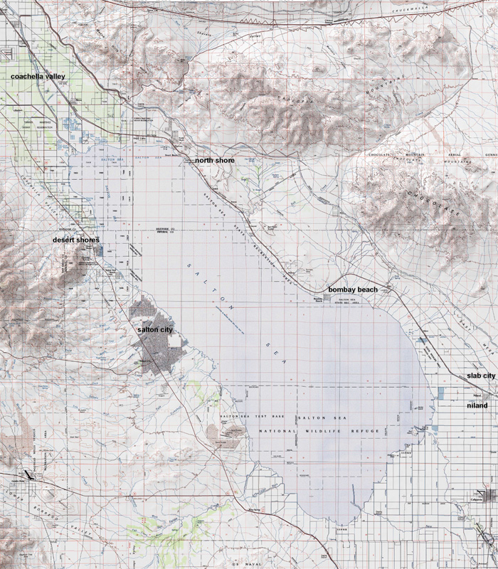
Salton Sea, California: regional study
The Salton Sea was formed when in 1905 the Colorado River burst through
irrigation controls south of Yuma, Arizona, flooding the Imperial Valley
in Southern California. Flooding continued for two years until a line of
protective levees were built by boxcars dumping boulders from Southern Pacific
tracks. By 1907, the newly named Salton Sea covered about 400 square miles
and was California’s largest lake. Today Salton Sea is approximately
35 miles by 15 miles across with an average depth of 29.9 feet and 51 feet
at its deepest, and over 100 miles of shoreline; it is located 228 feet
below sea level
The Salton sea has no outlet, meaning the only way water escapes is through
evaporation, it contains 7.3 million-acre feet of water and evaporates 1.3
million acre feet each year. But rather than evaporating away in a few years
as would be expected, the sea has remained due to constant agricultural
runoff from the surrounding irrigated farms. The agricultural runoff that
reaches the lake often contains concentrations of DDT, selenium and mercury,
which becomes concentrated as the water evaporates, causing a danger to
fish and birds. Salinity is currently 25% higher than the Pacific Ocean.
It is estimated that if the concentrated salt level of the Sea increases
another 2%, all the fish, except the Tilapia (a salt water shrimp), will
die off. Several proposal have been put forward to save the sea, the most
prominent involves creating a levee to split the lake into two halves (north
and south), one half would be allowed to salinate the other would be cleaned
up for recreational use and as wildlife sanctuary, this solution is estimated
to cost around two billion dollars and is seeking federal and state funding.
| intro | photo survey | bombay beach | slab city | salton city |